 Schafberg,
Austria
 Schafberg,
Austria
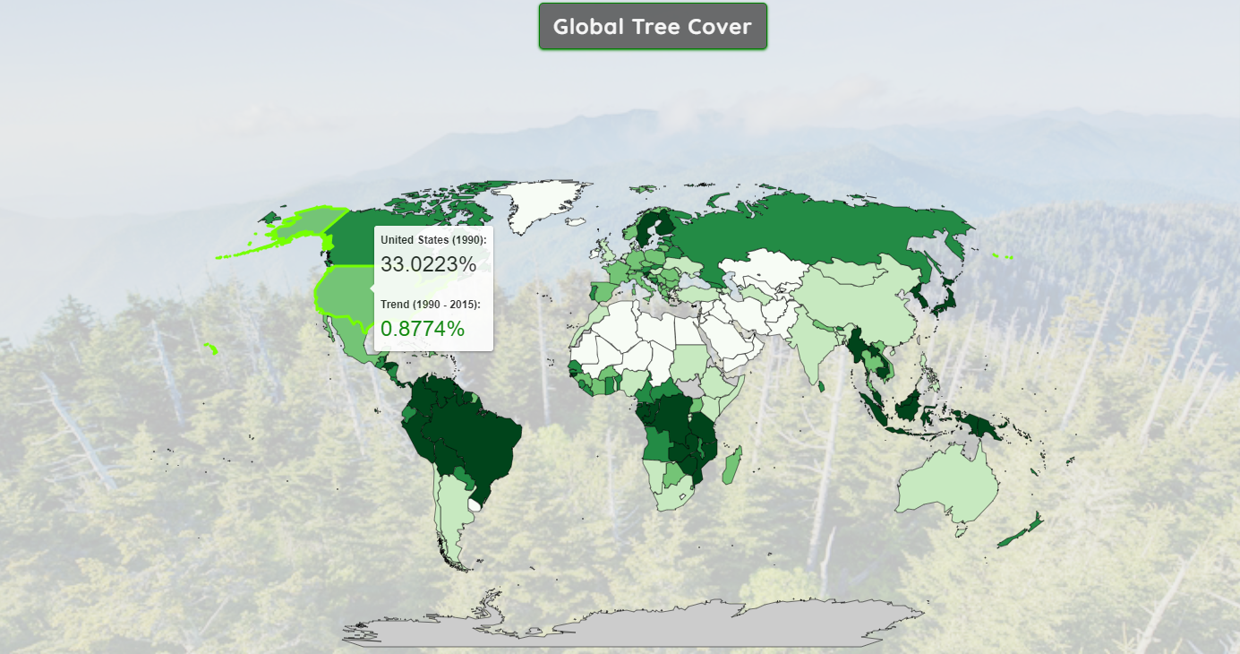
The overall amount of trees is believed to be slowly decreasing. The data, however, may prove otherwise, especially within individual countries. This map explores the changes in tree cover both globally and regionally.
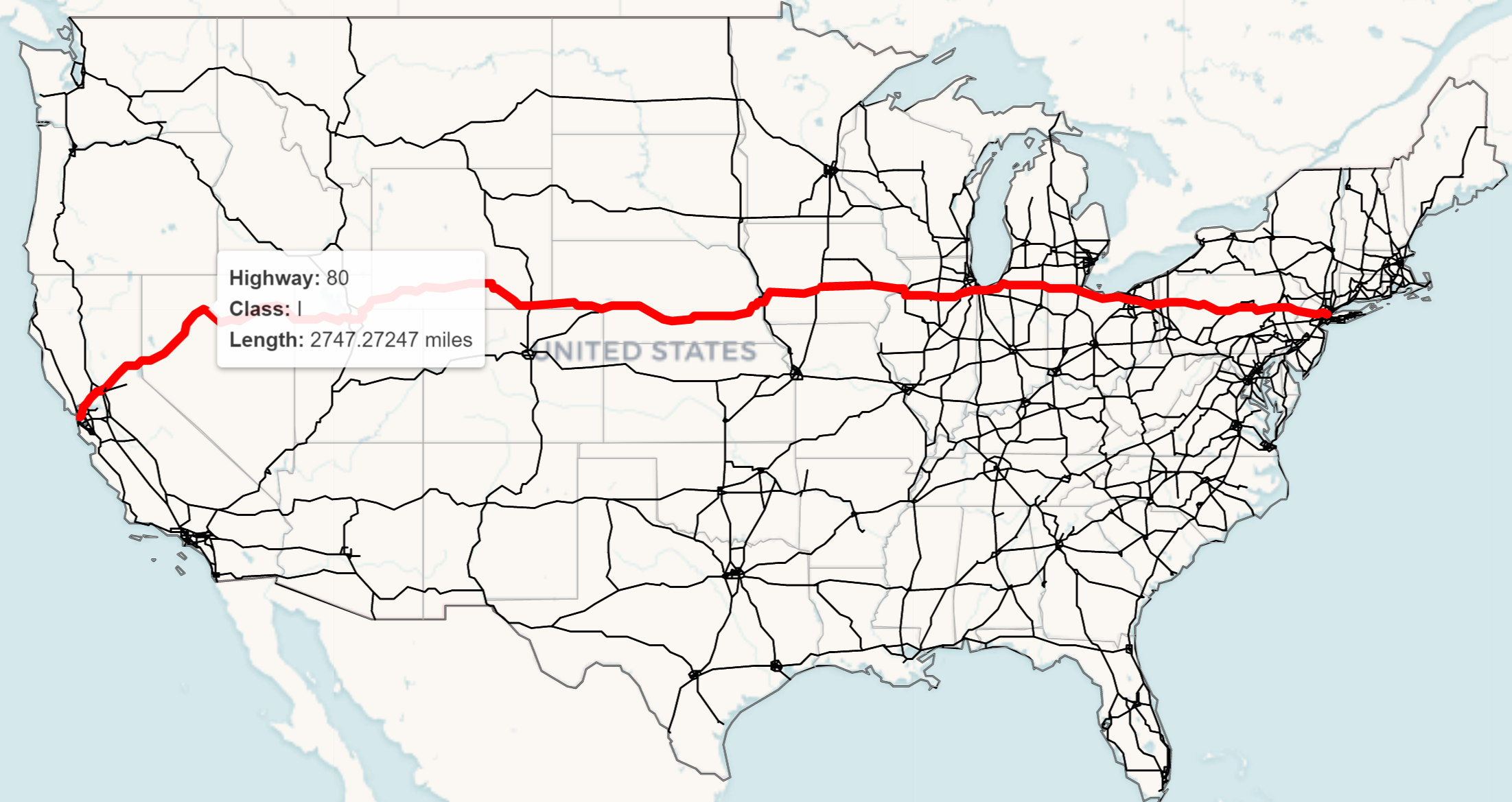
As the third largest country in the world, the United States relies heavily on the
interstate highway system for growth and travel.
Use this interactive web map to explore this network: in either miles or kilometers!
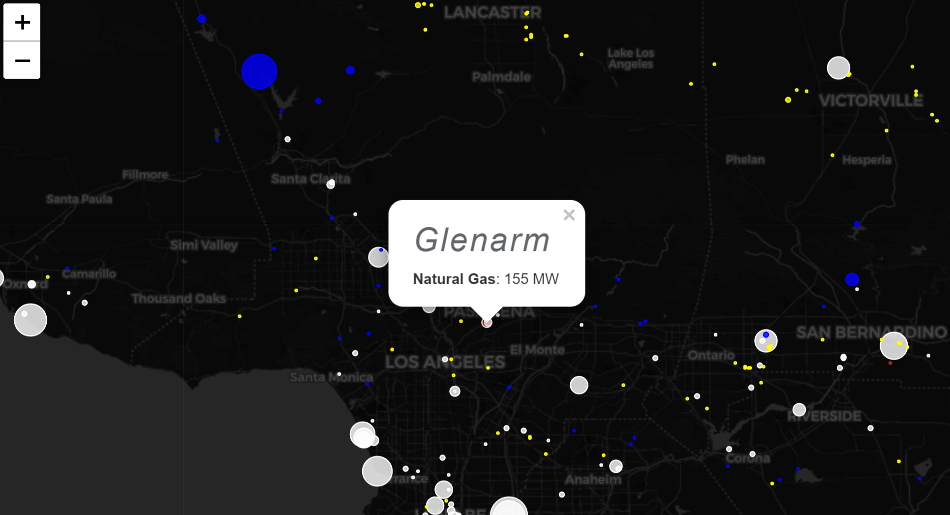
88% of all power plants in our country run on water, natural gas, petroleum,
sunlight, or coal.
Ever wondered where your electricity comes from and via which source? This map may have the answer.
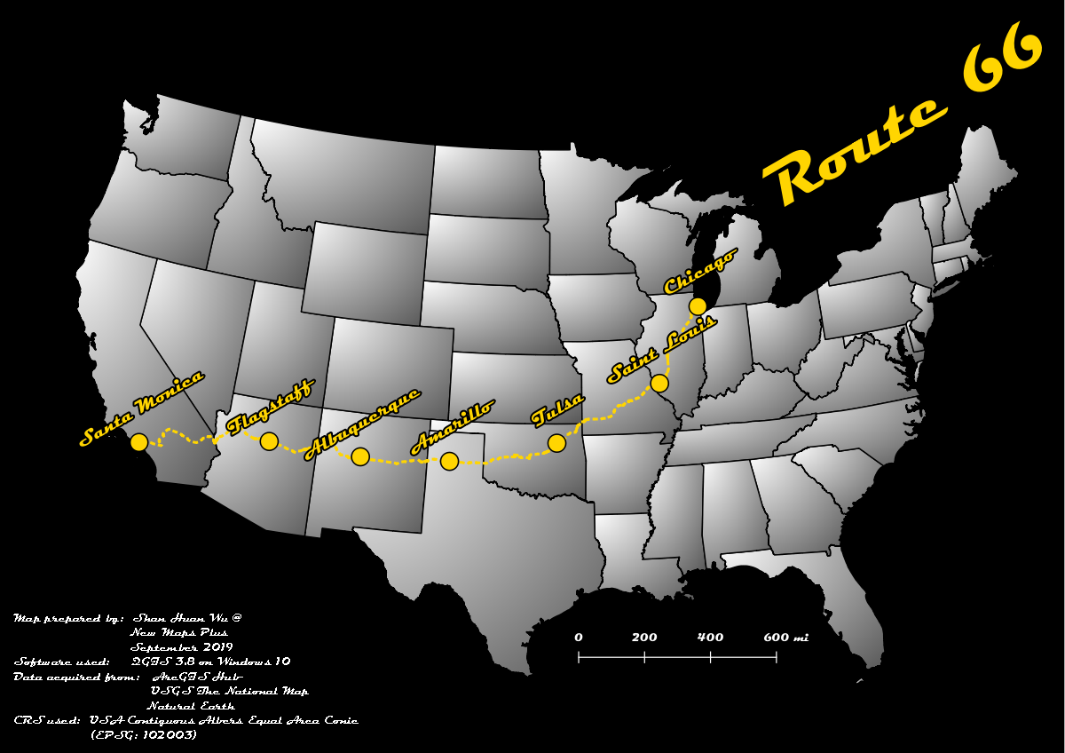
Plan your next roadtrip here!
The historic Route 66 covers 2,448 miles across the country from Chicago, IL to Santa Monica, CA.
*Includes images from my own trip!
10/12-10/22/2019
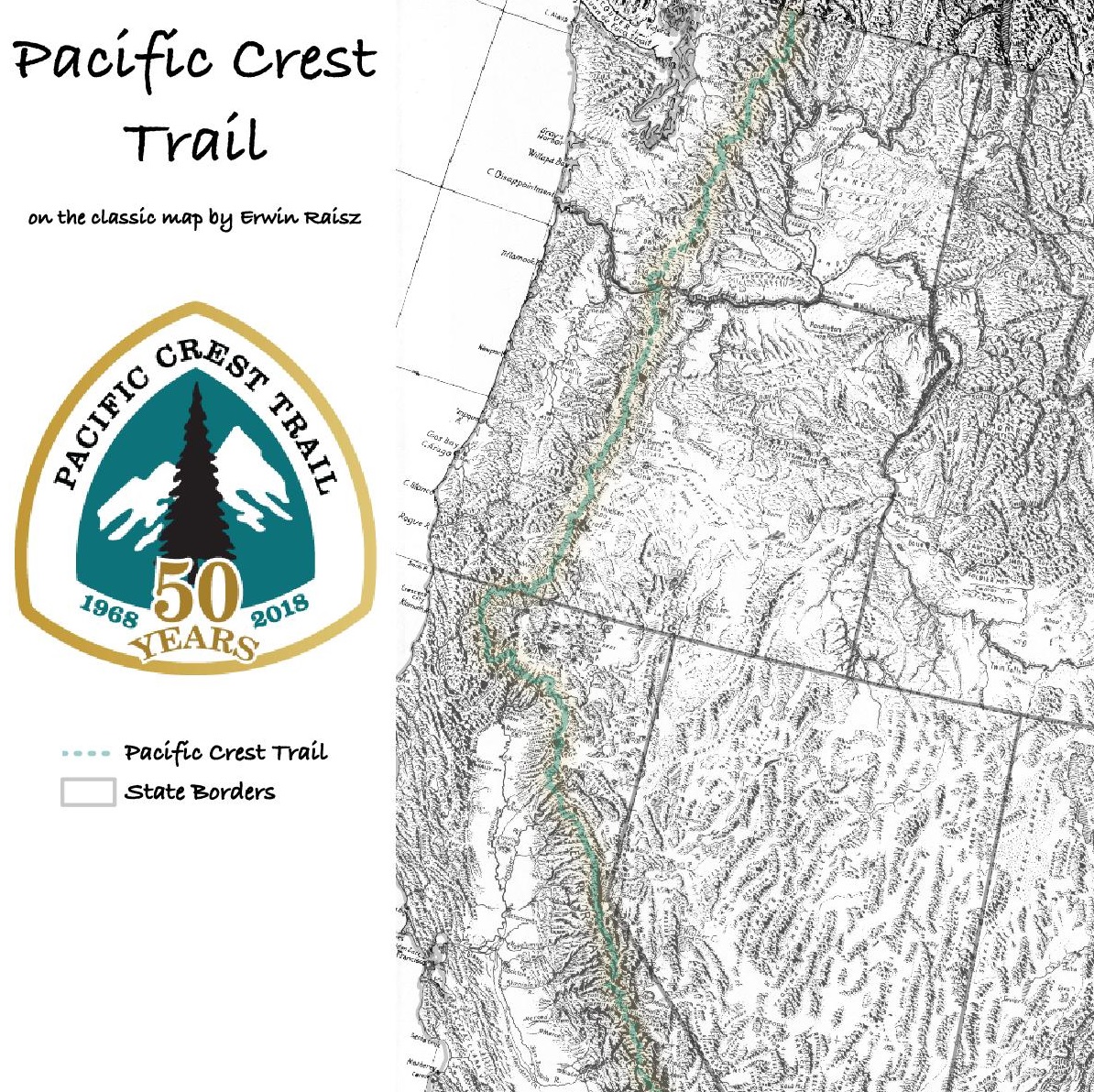
This georeferenced image maps out all 2,653 miles of the PCT on an Erwin Raisz landform.
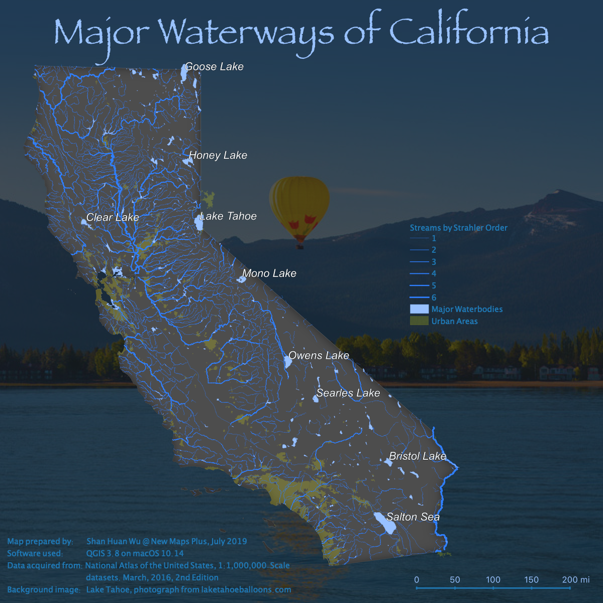
This static map made via QGIS details the streams and waterbodies in the Golden State.

Hi there, I'm Shawn Wu. My main interests revolve around front-end JavaScript development and web mapping with libraries such as Leaflet.
When I'm not mapping, I'm busy watching sports, playing video games, or traveling the
world!
(Banner image taken by me August 21, 2018)